Kennoway Den and Maiden Castle
A contrasting walk through the woodlands of Kennoway Den followed by a return route across open fields. Kennoway Den is an oasis of calm on the edge of a busy urban area of Fife. For a shorter walk it is of course possible to explore Kennoway Den by itself.
- Distance: 5 miles / 8km
- Ascent: 400 feet / 120m
- Terrain: Paths and tracks (some unsurfaced)
- Start / Finish: Windygates car park
Route Map
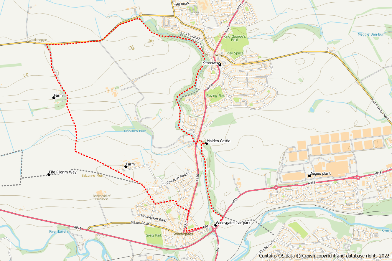
Start from the car park on the A916 at the Windygates Roundabout (grid reference NO 350 06). Initially head east on the pavement of the main road for about 140m (a purple arrow marker at the car park indicates the way) to reach two paths on your left. You can either choose the grassy path which will join the surfaced path later or go down the steps on to the surfaced path. This initial section of the route is along the line of the old East Fife Central Railway.
If you chose the surfaced path it is possible to make a detour to visit the Duniface triangulation pillar. Leave the tarmac path at grid ref NO 349 009 heading up a trodden path on your right beside an old fence and almost directly underneath an electricity line. Climb over the gate and proceed along the path along the embankment. Find a point where there is easy crossing of the fence on your left to reach the crest of the embankment and the trig pillar. Instead of returning, just return to the lower embankment path and follow it northwards, through woods, over a piece of metal fence and along a field edge. The path bears left to circle around Maiden Castle and back to the tarmac path.
After approximately 1km on the route of the railway, on your right hand side you will notice the hillock of Kennoway Motte or Maiden Castle. Just beyond the mound is a junction. If you go right at this junction and look for a gap in the hedge you can take a detour up a steep rough path to the Motte. This can be awkward particularly in the Summer months.
Return to the junction and leave the railway to walk out to the main road. Turn left and then turn right when you reach the green sign for Kennoway Den.
Go over the bridge following the purple arrow and then turn right at the next green sign for Kennoway Den, down some steps onto a path beside the burn. For the next 2km you follow the burn through the den of broadleaved trees with wild garlic and bluebells in the Spring. There are a number of bridges that cross the burn including the Spa Bridge which dates back to 1704. Keep on the west side of the burn until the path crosses over to the east side at a grassy area. Later the path will cross back over again before going uphill to emerge at a public road.
Turn left onto the road. Unfortunately it is not possible to walk along the verge and there is no pavement so you will need to walk on the road. However, it is a relatively quiet road although you will encounter some vehicles. It’s best to walk on the right hand side towards the oncoming vehicles. After about 10 mins you will reach a farm road on your left with a green sign for Windygates. Go down this road and once out of the trees you will have views across Leven and out to the Forth. When you reach Newton Hall farm, the path bears left on to an unsurfaced track with a faded green sign for Balcurvie.
The track takes you downhill to cross the Markinch Burn and then starts to gently go back uphill until you reach the first houses at Balcurvie. Bear right off the road onto an unsurfaced path. When you reach a green sign post at a junction go left and soon the path joins the access road to some houses.
When you reach the public road go right down the hill, then go left into Bankhead Place. When the road bears right, keep straight on to follow a path at the back of the houses. Turn right at the end of the path into Fernbank Avenue and left into Fernhill Drive. At the end of the road go right and immediately left into Dunolly Gardens with open space to your left. Go down a set of steps to emerge onto the main road close to the car park.
