Hills: Craigbeath Hill (181m), Albion Park (169m), Bankhead of Raith (164m), Tollie Hill (159m), Cormie Hill (158m), Peathhill (103m), Letham Hill (99m), Rigghead Hill (95m), Castland Hill (85m), Pinnel Hill (82m), Hillfield Crescent (77.7m), Ferry Hills (71m).
A selection of other listed hills with Tump status (thirty metre and upwards prominence) in the south and west of Fife.
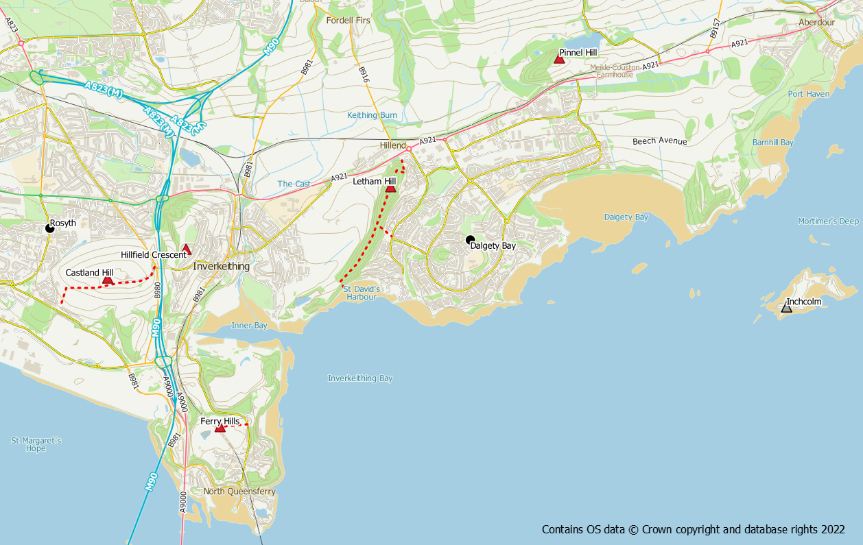
Maps


Cowdenbath and Lochgelly hills
Craigbeath Hill (181m)
The summit of this hill is nothing to get excited about as it is inaccessible due to a Scottish Water reservoir. However the walk through Leuchatsbeath Community Woodland is worthy in its own right. There is a convenient layby for parking on the A909 north of Cowdenbeath at grid ref NT 160 930. The woodland is well laid out with a network of surfaced and unsurfaced paths interspersed with picnic benches. Just follow paths uphill until you reach the reservoir compound.
Tollie Hill (159m)
This hill to the north of Lumphinans makes for a good viewpoint of the surrounding area. It’s summit is a rough grass pasture and is easily approached from the south east on a grassy path. The best start points are either Gagarin Way (through the playing fields) or Golf Course Road (next to the big gate with the Danger Keep Out sign). Use the path network to reach the north western corner of Lumphinans Pond where an old stile at NT 168 931 provides access to a grassy path up the hill via a gate at NT 166 932. It’s worth having a wander around the area of Lumphinans Pond whilst in the area.
Albion Park (169m)
Hardly worthy of being classed as a hill as this is just the highest point of the Lochgelly area and lies within the Albion Park football ground.
Inverkeithing and Dalgety Bay hills
Letham Hill (99m)
This is the high spot in the pleasant Letham Hill woodland between Inverkeithing and Dalgety Bay. The summit is easily reached by using a core path through the woods and can be accessed from the main road near the station or alternatively from the coastal path. There are other paths in the woods worth exploring.
Castland Hill (85m)
This hill lies on the route of the Fife Pilgrim Way between Rosyth and Inverkeithing. Access to the area is straightforward on the path from Rosyth or road from Inverkeithing. However, the a actual summit and its trig point are in a fenced off Scottish Water compound.
Pinnel Hill (82m)
Located on the higher ground to the north of Dalgety Bay, this hill has decent views out across the Forth. Access is possible by climbing a gate at the side of South Lodge underpass and heading up the field towards the mast. The summit is in the trees though (not where it is marked on the current OS map) and the fence needs to be climbed in order to reach it.
Hillfield Crescent (77.7m)
Barely worth mentioning but it does now have the status of a Tump so am including it. This is simply the high spot of a residential street in Inverkeithing.
Ferry Hills (71m)
This summit is a short walk up a Scottish Water track from the “back road” between North Queensferry and Inverkeithing. The summit is to the back of the fenced off compound.
Kirkcaldy Hills
Bankhead of Raith (164m)
This hill is simply the high point of the core path between Torbain and Auchtertool. It is only about 200m from the public road.
Cormie Hill (158m)
This hill lies on the Raith Estate which does not encourage walkers. As such access may not always be possible particularly during the shooting season. The hill is topped with a the Raith Tower folly.
Devilla Hills
Peathill (103m)
At 103m this is the highest point within Devilla Forest. It is easily reached by forest tracks and the summit conveniently lies at the side of the track and not deep within the forest.
Rigghead Hill (95m)
This hill and its trig pillar are located at the high point of the West Fife Link path between Devilla Forest and Balgownie Woods. The hill is equally accessible from either the Devilla or Balgownie side.
